England in all directions
I couldn’t leave Coldstream without visiting Lees Haugh, an area of field south of the town. A kind of peninsula, it is almost surrounded by the River Tweed. And as the Tweed forms the boundary between Scotland and England for most of its length round Coldstream, its meanderings mean there is an area of Lees Haugh from which it is possible to see England to the North, South, East and West while standing in Scotland! Here’s a map to illustrate.
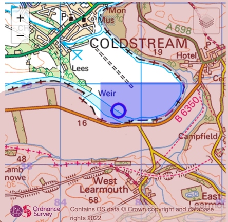
The area shaded red is England. The rest is Scotland, and the area shaded blue is that from which you can see England to all four points of the compass. Don’t roll your eyes like that – this sort of thing rates as interesting in my world.
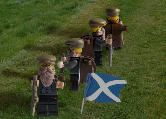
The blue circle on that map is where Lego Marchbanks is standing in the photo below, keeping a watchful eye on the border. It was taken by James T M Towill, who also was the choreographer. I suspect he watched A Hard Day’s Night quite recently. Photo © him (cc-by-sa/2.0).
Leave a Reply